Chincoteague National Wildlife Refuge |
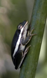
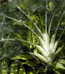
Our first stop was the Eastern Shore of Virginia & Fisherman Island National Wildlife Refuges. The southern tip of the Delmarva Peninsula is located between the Chesapeake Bay and the Atlantic Ocean. The area contains grasslands, croplands, maritime forest, and thickets. This land has been used for farming for hundreds of years. Captain John Smith described the area as "fruitful and delightsome land". At the mouth of the Chesapeake Bay, it was been used for military purposes throughout history. It wasn't possible to stop on Fisherman Island so we continued onto the Peninsula. A nice Visitor Center greeted us. The butterfly garden next to the Visitor Center was beautiful, but we missed the butterfly migration. We only saw a few butterflies along the trails. The 1/2 mile interpretive trail included a walk through the woods, past an old cemetery to a salt marsh overlook. We could see ducks, geese, egrets, herons, and other birds. We also climbed to the top of a WWII bunker. We could see salt marshes, barrier islands, bays, inlets, and the Atlantic ocean from the top of the bunker. The photo below shows a cute little green tree frog that Larry discovered when looking at the plants along the trail. The 1-2.5 inch green tree frog prefers moist shady areas.
It's amazing how much you miss when you don't look closely at the world. We heard people complaining because the butterflies were gone for the season, but we discovered quite a few were still left. We just had to relax and observe. Learn more about the Biology of the area at the Eastern Shore website. |
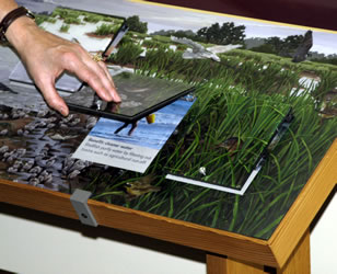
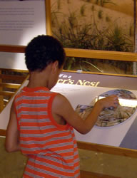
We crossed the bridge onto the island and stopped at the Chincoteague National Wildlife Refuge. The refuge includes more than 14,000 acres of forest, marsh, dunes, and beach that spans the two states (Virginia and Maryland) on Assateague Island. The new visitor center contained some great interactive exhibits. The building had an innovative passive solar system. |
  |
We drove through the park and saw Chincoteague ponies at a distance, but none came close to the road. |
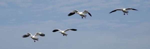
The island is on the Atlantic Flyway, so it is a popular resting and feeding spot for migratory birds. Current emphasis is on protecting the snow geese.
|
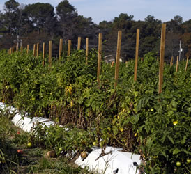
The ranger was correct about the drive. We were surrounded by beautiful farmland. We stopped to take pictures of the tomato farm on the left. |
Go to Lamb & Johnson Menu
|
 We enjoyed our drive from New England to Staunton, Virginia. After parking the motorhome, we took the Jeep to Virginia Beach where Annette spoke at a conference. The next day we headed north to Maryland on the
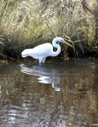
 We continued our drive north through some beautiful farmland then headed east toward Assategaue Island. We passed a large NASA facility and stopped at the subway in Chincoteague for lunch.
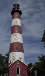 Our next stop was the USCG Lighthouse built in 1833. A short trail lead to the pretty lighthouse. The stripes were added in 1963. While Annette sketched, Larry took photographs and sang songs from the movie Pete's Dragon. He always breaks into song when he sees a lighthouse.
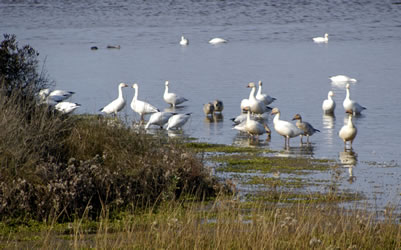
 We ended up at the Tom's Cove Visitor Center. The ranger in the visitor's center said that it was a nice drive up highway 12 and 113 to the northern visitor center. We thought that if we left immediately, we might still get to the northern unit before dark.