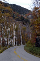
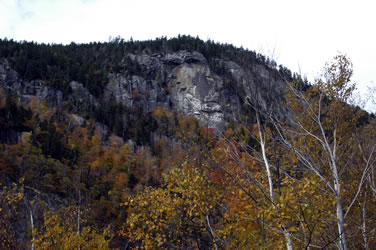
Update: New Hampshire Day 1 Bangor Maine to Freedom New Hampshire Rather than taking the interstate, we decided to explore the backroads of western Maine on the way to New Hampshire. Our travels took us along Highway 2 through many small towns. At Gilead, we turned south on Highway 113. We were a little concerned about the very narrow road, but with limited traffic we felt safe. The leaves were at peak colors which added to the wonder of the area. Because the road was so narrow, there were few places we could stop. However there was a small pull-out at Evans Notch where we stopped to take the photos below.
|
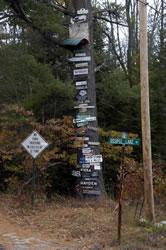
Entering New Hampshire At Fryeberg we headed west to Conway, then south to the Danforth Bay Campground near Freedom, New Hampshire. The photo on the right shows the turnoff near our campground. We noticed many areas in New Hampshire where the trees were used for these kinds of signs. Although there were too many trees for our satellite connection, we weren't worried because the park had wireless Internet access. |
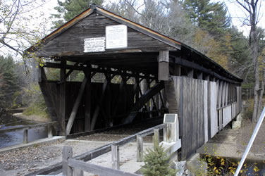
Whittier Covered Bridge After catching up on work, we took a couple hours off to check out a covered bridge near the campground. There are many covered bridges in New Hampshire. The one below is called Whittier Bridge. It's number is New Hampshire #46. It was located off Route 16 at West Ossipee Village on old Route 125 over the Bearcamp River.
|
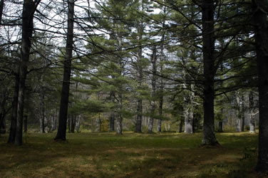
The Grove Along with the covered bridge, we also enjoyed the grove of trees along the road. It reminded Annette of playing in the Grove across from her grandmother Bolger's house.
|
Go to Lamb & Johnson Menu
|