Capitol Reef: Back Country Drive
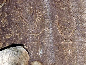
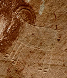
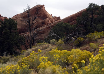
Fruita Historic District Our day's travel started with a stop in the Fruita Historic District. The Fremont Indians lived in the area of Historic Fruita for hundreds of years. They raised corn, squash, and beans in the area using irrigation. Today, visitors can see petroglyphs left by these people at the base of tall canyon walls. |
 |
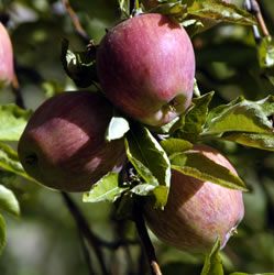
Fruita Orchard
The apple trees were loaded with ripening fruit. Plastic bags and a self-pay station are provided for visitors. There are several ladders located conveniently around the orchards. We had a great time picking and eating a variety of apples. We were amazed at their flavor. We had forgotten how much is missing in the apples purchased at most markets and grocery stores - - where size, color, and transport characteristics outweigh freshness, taste, juiciness, and nutritional factors. In addition to these great fruit trees, we also discovered more petroglyphs along the canyon wall beyond the orchards.
|
  |
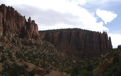
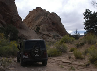
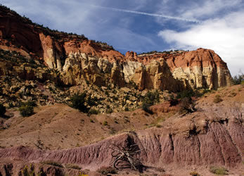
Waterpocket District Leaving the orchards with our bag of fresh apples, we drove east of Fruita and then turned south onto Notom-Bullfrog Road. The Waterpocket District is the southern section of the National Park. The monoclines Waterpocket looks like a series of huge folds in the rock layers. This dramatic, colorful rock wall goes on for a 100 miles. Although it was gravel and dirt, the road was in pretty good shape. We followed a 125 mile loop that included Notom-Bullfrog Road, Burr Trail, and finally back on Highway 12. Notom-Bullfrog Road follows the Waterpocket ridge south along the eastern edge of the National Park. After passing the old Notom town site, we continued south. Cedar Mesa Campground is in the middle of nowhere, 31 miles south of Highway 24. Although we couldn't bring our motorhome there, the small campground has sites that would work with a Class C RV.
|
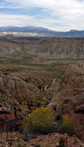
The road runs along Strike Valley. We stopped along the road at an area called Oyster Shell Canyon and found fossil shells everywhere. We continued down the road and saw hills of bentonite. They looked like soft hills, but they were actually hard rock.
|
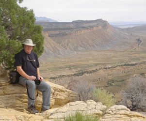
With limited time, we decided to leave the drive to Bullfrog for the next trip. Instead we turned west on Burr Trail. One of the highlights of the day was driving up the steep switchbacks of Burr Trail through the ridges and folds of the mountain. We found a great secluded picnic table for our lunch stop. We had views of the switchbacks and Henry Mountain off in the distance (Photo on right) from our picnic area.
|
|
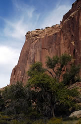
After lunch and a short drive, we took a 4-wheel drive on a spur road through Upper Muley Twist Canyon. |
|
It was impossible to grasp the wide landscape with a single photograph. We walked along the top of the fold, stopping to photograph and sketch, and enjoyed the views.
|
  |
|
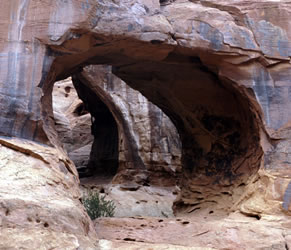
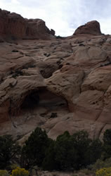
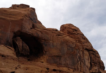
On the drive out of Muley Twist Canyon, we examined a double arch as well as other arches and interesting rock formations high on the cliff walls. |
  |
|
 |
After returning to Burr Trail Road, the gravel soon became an asphalt surfaced road. The drive through Long Canyon was also spectacular. Since it was getting late, we skipped Wolverine Road and a hike at The Gulch.
|
 |
|
|
Burr Trail Road ends in the small town of Boulder on Highway 12. We arrived at the state park as they were closing. However we managed to get a stamp for Grand Staircase Escalante National Monument and the Anasazi State Park dated Sept 23, 2005.
|
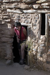
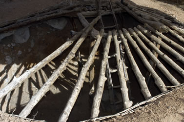
We did a quick walk through the museum, then spent a few minutes exploring the ruins behind the building. Below is an opened kiva.
|
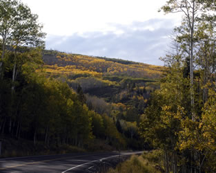
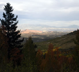
The last portion of our day trip was an unexpected pleasure. We headed across the slopes of 10,000 foot Boulder Mountain into miles of golden Aspens. Several USFS campgrounds are located along the highway, so we spent some time exploring some of them. They'd be great for dry camping.
|
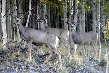
As we were coming out of the mountains, we encountered three beautiful mule deer in the aspens.
|
| Next time in the area, we would like to spend some time in the Henry Mountains south of Hanksville. Also the beautiful Boulder Mountain area has many backroads that we'd like to explore. Because of recent rains, many of the dirt roads in the northern area of the park were closed, so this is another thing we will have to leave until our next visit. |
 |
Go to Lamb & Johnson Menu
|
 We got up early for our back country drive through the park. It was a strange day. We were waiting for Hurricane Rita to hit the Louisiana and Texas coastline. The city of Houston was evacuated and our mail-forwarding service in Livingston was shut down. Annette talked to Arrion (Her sister in Richardson, TX) on the phone, who said that Dallas was packed with evacuees.
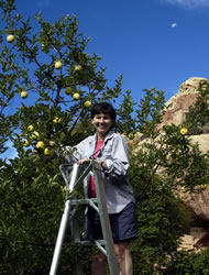

 Burr Trail Road
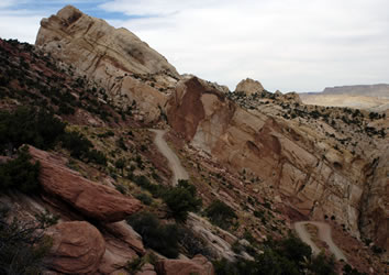
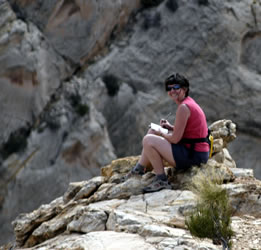
 Upper Muley Twist Canyon
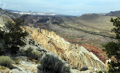
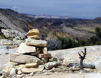 At the end of the road, we hiked to the top of the ridge. The trail led us along a sand wash and then up across slickrocks to reach the summit and an unbelievable view of Strike Valley.
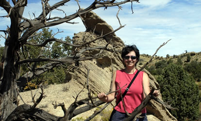
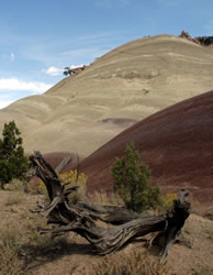
 Boulder Mountains