

Whether taking a virtual hike to learn more about glaciers and geysers or exploring social issues related to poverty and land use, Google Earth and GIS (Geographic Information System) resources are a wonderful way to bring the world into your classroom. In this workshop, you'll learn to use Google Earth and apply a variety of GIS resources across the K-12 curriculum.
Bring literature alive through visualizing the settings of picture books and novels. Add relevance to social studies, science, and math activities with access to endless real-world data sources. Enrich cultural and language studies with an exploration of geography and travel. Immerse young people in history by following the Oregon Trail, tracking the movement of troops through conflicts, and imagining life on the Silk Road using satellite images, photographs, and maps. Content place-based learning with global exploration for an engaging, interdisciplinary approach that addresses both standards and individual learning needs.
The old way is to look at a map. The new way is to explore our world.
Open Google Earth. Use the Search box to locate your town. Then, try another place in the world.
 Geographic (spatial locations, maps (points, lines, polygons), Information (selected data with specific attributes), Systems (organized processes)
GIS allow users to identify, gather, organize, analyze, and manage data. This data can be used for problem-solving activities:
GIS is a type of database containing geographic attributes that generates digital maps and other products. Users collect, enter, retrieve, analyze and present information using specialty software. ArcView from ESRI is probably the best know GIS software.
Geographic Objects
Viewing GIS Information
Explore National Atlas as an example of GIS. Look for the features of GIS.
Why GIS? A knowledge of geography is essential across the curriculum. You can't understand the War in Iraq without understanding the geography of the Middle East. To empathize with the Inuit Indians, children need to understand the impact of global warming on the geography of the Arctic.
As you design instruction for 21st century learners, consider ways to address individual differences through activities that differentiate experiences. One way to do this is by adjusting the content, processes, and products of learning. Let's look at a science example.
The Content. Traditionally, young people have learned content from lectures and text-based books. Explore ways to bring content alive by connecting traditional resources with geographic information systems. Bring your personal experiences into the classroom by showing young people places you've been through photographs.
Turn a traditional unit on glaciers and climate change into an adventure! For instance, after reading the book The Inconvenient Truth, watching the documentary, or exploring the website. We read related articles such as Climate Change Hits the American West by Todd Wilkinson. We decided to hike to Grinnell Glacier before it totally melted and recorded our experiences using photos. Then, use tools such as Google Earth to provide a virtual field experience such as a trip to the Grinnell Glacier in Glacier National Park.
The Process. Use a variety of visuals to express geographic information. For instance, you might involve students in comparing historical images of Grinnell Glacier with new images. Sources of information: First Gov - data, photograph, Wikipedia - Retreat of Glaciers
The Products. Involve young people in creating powerful products using GIS resources. For instance, ask students to explore other areas of the world being impacted by global warming. Or, explore another area of concern such as global poverty. Use GIS to collect images and Comic Life to display the results.
Use the controls on the right side of the screen to navigate.
Explore the layers provided by Google. Use the checkboxes to turn these on and off.
Use the placemark option to keep track of places you want to visit again.
Identify a place in your local community. Create a placemark. Include descriptive information.
Use the ruler to identify distances between places.
Brainstorm ways to use the ruler in teaching and learning.
You can create KML files with the Google Earth user interface, or you can use an XML or simple text editor to enter "raw" KML from scratch. KML files and their related images (if any) can be compressed using the ZIP format into KMZ archives. To share your KML and KMZ files, you can e-mail them, host them locally for sharing within a private internet, or host them publicly on a web server. Just as web browsers display HTML files, Earth browsers such as Google Earth display KML files. Once you've properly configured your server and shared the URL (address) of your KML files, anyone who's installed Google Earth can view the KML files hosted on your public web server.
Many applications display KML, including Google Earth, Google Maps, Google Maps for mobile, NASA WorldWind, ESRI ArcGIS Explorer, Adobe PhotoShop, AutoCAD, and Yahoo! Try the KML Tutorial or read KML Documentation.
Locate KMZ files
Explore an example project. Watch Tutorial 1 and 2 from the Christmas Card project for a great explanation of creating and sharing KML files
Share a KML/KMZ file.
Although Google Earth is the most popular, there are other software application such as WorldWind - virtual globe from NASA (images are public domain) and Microsoft Bing Maps from Microsoft.
Google Earth - a geographic browser. KML (Keyhole Markup Language) is similar to HTML and is used to access examples.
Educators can get Google Earth Pro for free. Learn more. Download PDF.
Google Earth Showcases and Galleries
Google Earth Blogs and Forums
Google Earth for Educators
Google Earth Educational Resources
Other Resources for Google Earth
Open Google Earth. Take a virtual trip around the world. Start in your state, country, continent and beyond. Explore lots of examples in the Gallery and Outreach areas.
Search for places in the world you'd like to visit such as Paris. Or places you study such as Rome.
Whether you want to visit art museums, explore architecture and scupture, or be inspired by landscapes, explore Google Earth.
Search for the Eiffel Tower in Paris and the Museum Prado in Spain.
There are endless applications of GIS in Social Studies.
Historical Map Collections
Compare historical maps with Google Earth images focusing on changes in natural areas and urban areas. Many maps are available in Google Earth. Look for Rumsey Historical Maps from the Gallery in Google Earth.
Explore Creating a History of Hartford.
Go to the Civil War Literature Wiki. Explore historical fiction books set in different regions of the United States. Use Google Earth to explore specific battles and explore relationships. Examine books with a midwest setting:
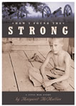 Use Google to locate a wide range of multimedia resources including visuals, maps, and videos. Let's say you're doing literature circles on the topic of Civil War and students are working on the CivilWarLit wikispace. One group might be reading the book "How I Found the Strong" by Margaret McMullan set in Mississippi during the Civil War. Another group might be reading "Shiloh Attack: Battle of Shiloh" by Hama, Wagner, and Moore. Students might search for resources about the key battles (Battle of Shiloh) discussed in the book.
A Single Shard by Linda Sue Park is set in Ancient Korea. Trace the journey of the young character. Compare Korea then and now through maps.
Read books set in the Great Depression. Compare the movement of people in different books including Grapes of Wrath, Out of the Dust, and Bud Not Buddy. Think about what would happen if book characters interacted. Map their movements and interactions.
Read Crossing the Wire by Will Hobbs. Also, explore Immigration Stories from ALA. Use Google Earth to explore a possible immigration path between two countries such as Mexico and the United States.
Other books might include Grandfather's Journey. Use Google Earth the visualize the journey. Then determine the miles. Create your own map with distance information and drawing.
Explore historical events from different perspectives. For instance, trace the steps of immigrants through Ellis Island as well as Angel Island. From what other directions did immigrants arrive in the United States? Look at your own community. How was it formed? Create a document exploring different perspectives. Use GIS tools in your exploration and sharing.
Explore websites with companion Google Earth tours
The following links will launch Google Earth
Explore the following ideas. Let's add more!
Regardless of the reader's age, GIS can bring a book alive. When young children are reading Make Way for Ducklings, Google Earth can identify the exact location of the story.
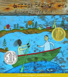
While intermediate students are reading Lizzie Bright and the Buckminster Boy, they may wish to compare the Atlantic coastline during the early 1900s and today.
Beyond simply using the book as a tool to locate places, think about how to extend the book. Read the book Tar Beach about flying over Harlem. Then. write your own flight stories.

 Consider a literature circle activity focusing on "road trips." Students could read books and use Google Earth to better understand the journeys. Some books might include
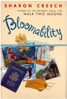
Let's use Bloomability by Sharon Creech as an example. It's the story of a teenager who moves to Switzerland to live with her aunt and uncle. Using Google tools you'll will find many ideas to enhance the teaching and learning experience.
Ask students to visualize a setting. Begin with The Lord of the Rings tour (KML) in New Zealand.
Explore my travel logs. Notice how I combined Comic Life with Google Earth images.
Explore to Google Lit Trips - "A Different Way to Read Great Literature" for ideas of how to integrate Google Earth into Literature. Be sure to check out the student-produced "Into the Wild" trip. Also check out Fever 1793 and A Family Apart.
If you want to create a virtual tour for a book use Gutenkarte to extract geographic locations from public domain texts and shows geographic locations.
Search LibraryThing for settings.
Using Google Earth in the Foreign Language Classroom - A video essay suggesting possible uses for Google Earth video games in foreign language education. Keep in mind that you can change the language. Select Tools>Options>General.
The Rosetta Stone Project explores how Google Earth can be used in understanding language.
Explore the following ideas. Let's add more!
 There are many applications of GIS in Math and Science. Explore geographic areas before and after natural disasters. For instance, examine Hurricane Katrina Imagery from Google Earth.
Explore landforms such as volcanoes. To see volcanoes, simply choose the Layers Option and select Volcanoes under Gallery.
Some websites are providing tours on Google Earth. Check out the Cousteau expeditions.
Read Cruisin' the Fossil Freeway by Kirk Johnson and examine the map. Compare this map to Google Earth and other maps. Where are fossils found, why?
The following links will launch Google Earth:
Seek out projects that incorporate GPS and GIS information. These projects get young people involved in collecting, sharing, and analyzing information.
Explore Butterflies and Moths of North America. Notice how maps are geographic information is used in this database.
Explore the following ideas. Let's add more!
Explore Online Projects
Inquiry-based Learning
Escrapbooking
Read Al Capone Does My Shirts. Take a Google Earth tour of Alcatraz.
Brainstorm escrapbooking assignments that use GIS elements.
Read How to Lie with Maps and From Squaw Tit to Whorehouse Meadow: How Maps Name, Claim, and Inflame by Mark Monmonier for some interesting background information about maps and mapping.
Locate the same place using each tool. Compare the results and special features.
Geocaching is a popular sport that uses a GPS device to guide people to hidden treasures.
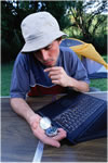
A GPS is a Global Positioning System that uses the Global Navigation Satellite System (GNSS). The GNSS contains 24-30 satellites working together to locate positions. The GPS receiver acquires the location, time, and velocity informaiton. It works by using information from multiple satellites to location your position. Your position is identified by coordinates (waypoints) involving latitude (east/west - equator) and longitude (north/south, Greenwich, England), and elevation (mean, sea level).
You can upload waypoints marked with your GPS to Google Earth
Go outside and set some waypoints. Connect your GPS to your computer and import your waypoints.
Explore online tools for creating maps and keeping track of information on maps.
Issue 1: Copyright - Remember that Google Earth is a company and you need to get permission to make use of their images. Consider using NASA's World Wind. The images are in the public domain.
Issue 2: Bandwidth - Try using Google Maps or other web browser-based tools.
Issue 3: Filters - Some schools have trouble with Google Earth with their filtered. For instance, if you fly over the Golden Gate Bridge you'll see YouTube videos and images. Are they filtered at your school? Be sure to check your links at school before using them with children.
Issue 4: Versions - Google Earth often provides new versions of the software. Be sure to update for the new materials.
